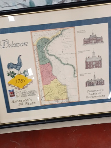
Reproduction of an 1838 map titled 'Delaware - America's 1st State' showing the state's geography and government buildings
Selling Price
$50
History
This map represents Delaware as it appeared in 1838, depicting the state's three counties (New Castle, Kent, and Sussex), the Delaware Bay coastline, and illustrations of important government buildings including the State House. The map reflects the early cartographic style of the 19th century, when such maps were essential tools for understanding territorial boundaries and civic infrastructure. Delaware, known as 'The First State' for being the first to ratify the U.S. Constitution in 1787, held significant historical importance during this period. Historical maps like this appeal to collectors of Americana, cartography enthusiasts, Delaware residents interested in their state's heritage, and history buffs who appreciate visual representations of early American geography. These reproductions allow people to own and display pieces that capture a specific moment in American history, making them popular decorative items for homes, offices, and educational institutions. The combination of geographic information with architectural illustrations makes these maps both informative and aesthetically pleasing.
Origin
United States
Time period
Modern reproduction of 1838 original