
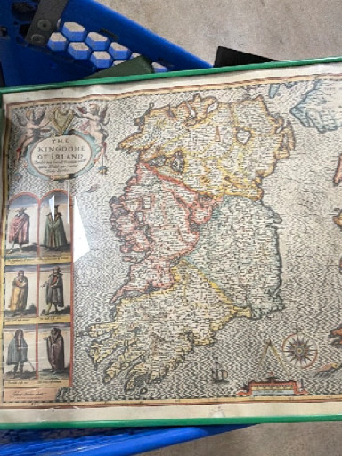
Hand-colored engraved map titled 'The Kingdome of Irland' by John Speed

History
This map was originally published by John Speed in 1611 as part of his groundbreaking atlas 'The Theatre of the Empire of Great Britaine,' the first atlas devoted exclusively to the British Isles. Speed's map of Ireland is notable for its detailed provincial divisions (Ulster, Leinster, Munster, and Connacht) and decorative cartouches featuring costumed figures representing Irish society of the period. The map became one of the most influential and widely copied depictions of Ireland in the 17th century, with later editions published throughout the 1600s and early 1700s. Speed's maps are highly prized by collectors of antique cartography, Irish historical materials, and decorative wall art. They appeal to those interested in the history of mapmaking, Irish genealogy, and British colonial history. The combination of geographical accuracy for its time, artistic embellishment, and historical significance makes these maps valuable to museums, libraries, and private collectors specializing in early modern cartography and Irish heritage.
Origin
London, England
Maker
John Speed
Time period
circa 1676 edition